I cannot trace the exact journey the apple in my hand traveled to reach me today. I can only imagine its voyage from the state of Washington—where it was grown, its sticker says—the many hands and many vehicles that ushered it along its route, the many turns on many highways, and then the routes it will follow within my body until its nutrients proceed along my many arteries. In this moment, I also consider all the food I have ever consumed, arriving via countless other routes, helping to lengthen my bones in childhood and building my body into what it is today. I ask myself: How did this food come to me? And on whose labor did I depend to receive it?
Growing up, a large portion of that labor was my father’s. He hauled freight in an eighteen-wheeler, moving food and other goods over mountain passes, from two-lane highways to ten-lane interstates and back again to our rural community in the Sierra Nevada, in order to earn the money that would buy food and goods for us girls. For forty-five years, he drove “in the high seat, before-dawn dark” as the “polished hubs gleam / And the shiny diesel stack / Warms and flutters,” just as Gary Snyder described in his poem “Why Log Truck Drivers Rise Earlier Than Students of Zen.” My dad rose early, worked overtime, and sometimes risked his life for his deliveries. He tells me, “I always felt responsible for the product because people relied on it so much.” Or, as Snyder wrote: “There is no other life.”
My sister and I depended on my father, his labor, his truck, and his route, and so did many others. He delivered packages and paychecks. “Especially on Fridays, they were happy to see me. I was very popular,” he tells me. And who doesn’t similarly depend on the people and routes that are part of the highway system, the biggest infrastructure project in US history?
In Oregon, trucks deliver their goods along the 79,167 miles of circulatory public road branching throughout the state. The food on any table almost certainly spent some time on a truck. Between 2010 and 2023, the share of trucks among all vehicles in the country grew by 38 percent. Once rarely the last mode of transit in the supply chain, trucks now often carry goods, especially those ordered online, directly to our doors, with the World Economic Forum (WEF) estimating that urban centers globally could see an 80 percent increase in delivery vehicles by 2030. The impact of this new reality is uncertain: While the WEF predicts a 60 percent increase in urban-delivery-related carbon emissions by that same year, the US Department of Energy cites a case study in Chicago showing that last-mile delivery by truck uses less energy and results in fewer vehicle miles traveled than a person making multiple individual trips to the store. Sellers jostle to get their food and goods delivered through this system, and consumers love the convenience it enables.
What are the costs of this increased efficiency and convenience to our communities and our environment? The same question was asked by the protesters and politicians who fought and ultimately stopped the building of the Mount Hood Freeway in Portland in the 1970s. Along the way, they redefined “progress” in Oregon and helped us reconsider the entire highway system. This protest, known as the Mount Hood Freeway revolt, and other freeway revolts, including those taking place today, prompt us to ask: What do we gain and what do we give up when we depend on this vast system of highways for our consumption? What do we demand of the highway system, and what does it demand of us?
No single planner, engineer, or politician envisioned the highway system as we now know it. It grew like any other organism, its branches finding its needs, working around obstacles. Its design is determined by the routes humans have already traveled, along older paths, by foot, by horse and buggy, by bicycle, by auto, and by truck. Decisions about which routes might metamorphose into an improved highway or a new freeway are influenced by federal, state, and local governments, car aficionados, industry groups, city planners, environmentalists, and sometimes even the people who live in the path of a proposed route. These decisions are at once bureaucratic and anarchic, collective and dynamic. In Oregon, the following entities currently have an official say in the development and maintenance of the highway system: the Oregon Department of Transportation (ODOT), the Federal Highway Administration (FHWA), the Oregon Transportation Commission (OTC), the American Association of State Highway and Transportation Officials (AASHTO), and in Portland, where I live, the Portland Bureau of Transportation (PBOT), Portland City Council, Multnomah County, and Metro. All of these entities are made up of people who depend on the system themselves. In 1966, Frank Turner, an administrator for the federal Bureau of Public Roads—and later its successor, the FHWA—said, “There is no reason for highways apart from people. Very simply, highways are people.”
The US highway system is so vast and complex that it defies metaphor: Arteries and veins work until I think of two-way flow in a single capillary. Miller McClintock, an expert in traffic control who studied at Harvard University in the 1920s and ’30s, preferred fluvial terminology, using stream and water imagery to describe his “friction theory” of traffic, the flow of cars encountering obstacles and counterstreams. That makes sense until you hit a lake or contemplate the headwaters.
I cannot find an analog for a system that grows and abandons and then generates its own activity along its established branches, both responsive and rigid, or one that grants humans mobility and access to goods but also displaces them and dries up their livelihoods. Perhaps one of the only universal qualities of systems this large, human or otherwise, is that they pay little heed to the individual. Our highway system can dispossess people of their homes. It pressures all in its path to bend to its will. It incuriously claims to know what is best for all and demands involuntary sacrifices. It can be cold and untender with its help.
Imagining the highway system as a network of rivers and streams is insufficient, but at least it’s based in history: Waterways have served as overland transportation for millennia. The muddy roads and streets that preceded macadam and concrete—and the rail system that wound its way through the continent, creating both boomtowns and ghost towns in its wake—often followed rivers and gulches, the path of water’s flow. One of the main east-west Union Pacific freight lines in Portland follows the Willamette and Columbia Rivers as well as Sullivan’s Gulch, excavated by the Missoula floods some fifteen thousand years ago.
Around the turn of the twentieth century, Portland’s real estate developers assisted the growth of a streetcar rail system, building their own trolley routes to new neighborhoods like Ladd’s Addition and Eastmoreland, connecting commuters to downtown and establishing the city as a leader in streetcar transport, with the third-largest urban rail system in the US. Then came more horseless carriages: autos, buses, trucks. We poured pavement over the streetcar tracks, which sometimes reemerge deep in potholes or on forgotten side streets, like archaeological treasures.
As highways expanded throughout the city and state, the trailers pulled by trucks grew longer. Longer combination vehicles, including Rocky Mountain doubles (two trailers of different lengths), turnpike doubles (two trailers of the same length), and triples, or A-trains, are allowed on most Oregon roads with a permit. “Truck platooning,” or multiple semiautonomous trucks traveling in a close convoy, may be on the horizon.
It was in the interest of truck travel that then-Lieutenant Colonel Dwight Eisenhower led a Lewis-and-Clark-esque trial expedition of eighty-one army trucks across the country in 1919. The Motor Transport Corps convoy, traveling to San Francisco from Washington, DC, was intended to assess the potential for transcontinental transport of military supplies. The almost impossible adventure started by parading with pomp around the ellipse in front of the White House, then proceeded across the somewhat established Lincoln Highway—but the trucks would ultimately need to be hand-pulled by yoked troops, foot by foot, across the salt flats in Utah. Depleted, the convoy arrived in San Francisco a week late. When Eisenhower became president in 1953, he drew on this experience to champion an interstate highway system.
In 1943, City Commissioner William Bowes kept the flow of humans and goods—and the employment of soldiers returning from World War II—in mind when he helped summon notorious New York City planner Robert Moses to recommend highway and park projects for the rapidly growing city of Portland. Moses’s report, titled Portland Improvement, recommended constructing inner-belt thruway arteries on either side of the Willamette River, with connecting bridges. Inspired by Moses, Bowes and the Portland-Vancouver Metropolitan Transportation Study group (delightfully abbreviated as PVMTS) endorsed parts of a 1955 Oregon State Highway Department (OSHD) plan that would have sliced up the city along a vaguely east-west and north-south grid, aligned with its busiest thoroughfares: 39th Avenue, Fremont Street, Columbia Boulevard, Division Street, and Powell Boulevard. More freeways, more flow, they reasoned.
My dad didn’t just spend his working life on the road, but his vacation days as well. “There’s nothing like the pleasure of the open road,” he tells me. “No pushing or pulling, just you and a cup of coffee and good music.” His road trips were on the groovy side, in a van with a built-in bed, a CB radio, and a stereo system that pumped out mixtapes full of Motown and surf classics that we girls knew by heart. We journeyed along Highway 50, the loneliest highway in America, on our way to the Great Basin in Nevada, and bounced along dirt roads in Baja California, outside San Felipe.
Even off duty, my dad loved the truck stop diner, where we would break for an hour to slurp down orange juice and bite into toothpick-skewered BLTs. These mom-and-pop businesses eased travelers like us off the highway and then back onto the road, positioning themselves strategically on the shoulders of rural highways as towns reoriented themselves away from rivers and rails and toward the concrete expressways.
The highways that carried us to these diners also disrupted the supply of food to communities. Highways were intended to make the distribution and consumption of goods easier, but highway planners could dispossess farmers of their farmland in the right-of-way, shutting off the local food supply. In 1959, Iowan officials estimated that their 710 miles of freeway had eliminated twenty-six thousand acres of working farmland, sometimes dividing family farms, encouraging the sale of amputated parcels, and forcing some farmers to travel farther to maintain their farms or sell their food.
To accommodate highways, urban areas reconfigured themselves in even more dramatic ways than small towns did. When bridge builders laid down the last section of the Marquam Bridge in 1966, state politicians officially declared Interstate 5 complete through the state of Oregon. At the celebration, Eugene W. Bauer, president of the League of Oregon Cities and mayor of Gladstone, hailed I-5 as “one of the greatest of economic arteries.” These arteries carved their way through existing human habitats. Regarding his highway building in New York, Moses commented, “Progress sometimes involves some temporary hardships,” and “You can’t make an omelet without breaking eggs.” In the early 1960s, the construction of I-5 fractured communities in Portland, including Albina, which was home to 80 percent of the city’s Black population at the time. Construction of the North Portland leg of I-5, dubbed the Minnesota Freeway after the street dug out to accommodate it, forced people out of all adjacent homes and businesses, which were demolished. One auction at the time listed prices between $50 and $155 for homes and their contents on land that was taken through eminent domain.
Our highways collide with adjacent natural systems as well, disrupting animal migration, water flow, and food sources. Each rainy season in Portland, volunteers for the Harborton Frog Shuttle gather northern red-legged frogs in buckets to escort them across four lanes of traffic, from their breeding ground in the wetland adjacent to Highway 30 to their summer habitat in Forest Park. And each year, the federal Department of Transportation reports that vehicle traffic is the primary cause of death for a large number of mammal and amphibian populations, including bears, Florida panthers, and bighorn sheep, as the migrating animals travel their deeply instinctual and generational paths. These collisions also result in roughly two hundred human fatalities, twenty-nine thousand human injuries, and $1 billion in damage.
All those years, my dad delivered goods to those who needed them, day in and day out, carefully packing his truck and monitoring the temperature in the reefer: “Keeping the frozen food frozen and the unfrozen food unfrozen,” he says. What catches his memory most are the perilous days: When the trailer’s sliding swing door at the tailgate took off the tip of his finger. When he drove the highway through wildfires, feeling the fire’s heat through the door as he carefully eyed the fuel tank in his side mirror. When he served as a decoy driver during Queen Elizabeth II’s visit to our community, first masquerading as transport for her luggage and then delivering the real deal to Air Force Two at Castle Air Force Base. And when he narrowly escaped a potentially fatal rockslide thanks to the careful intuition of a ranger, who saw a few loose rocks tumble across a mountain road and decided to close it.
Peril came with relentless regularity in the high country of the Sierra, where my dad threaded his truck along narrow lanes and barriers, tracing the omega-shaped curves of mountain passes. One summer, a massive fire erupted along his route, blocking all passage and flooding the area with thousands of firefighters who rushed in to tame it. Forced to abstain from all alcohol and smoking while stationed in the forest, the firefighters quickly emptied the shelves of the only grocery store of chewing tobacco. One day, hoping to shorten his arduous detour, my dad pulled his rig up to the blockade and shared his position. “You don’t have any Copenhagen or Skoal in that trailer, do you?” the fire crew asked, with what I can only imagine as faces filled with hope. “Yes,” my dad replied. “I have a full pallet of Copenhagen.” The crew let him through that day and for the rest of the days they spent fighting the fire. My dad only had to utter the word “Copenhagen” at the blockade as a lighthearted greeting and makeshift password.
While some celebrated the expansion of the interstate system and its unblocked flow of vehicles and goods, others revolted against it. Sentiment toward urban freeways soured in Oregon and across the US during the 1960s and ’70s, and broad, diverse coalitions formed in major cities to oppose them: in San Francisco against a freeway spanning the Panhandle and Golden Gate Park; in New Orleans against the Vieux Carré Riverfront Expressway along the French Quarter’s waterfront; in DC against the Three Sisters Bridge over the Potomac River; and so on, in many other cities.
Freeway revolts heated up in Portland as the interstate system grew. Albina residents resisted the construction of I-5, including several hundred who banded together to form the Minnesota Property Owners Association—but the project plowed ahead anyway. Transit officials then set their sights on building other freeways, including I-205, a north-south bypass to I-5, as well as east-west freeways to connect the two interstates. I-205 was penciled in to many neighborhoods and then erased due to protests—first in Lake Oswego, then the Laurelhurst neighborhood, then along 52nd Avenue—before it was finally marked in ink just east of 92nd Avenue. In 1967, the residents of Maywood Park, a triangular housing development in unincorporated Multnomah County, found themselves squarely in the path of the proposed freeway. To save their homes from eminent domain, the residents incorporated their neighborhood into a city. The move, bold as it was, failed to save eighty-seven homes in the freeway’s path. Opponents of the Rose City Freeway, or Fremont Freeway, which would have connected I-205 to the Fremont Bridge along Northeast Prescott Street, were more successful: Residents of Albina protested, preventing even more homes in their neighborhood from being razed for freeway construction.
The Mount Hood Freeway was another planned east-west highway, following a historical route once used to carry goods to Portland from farms in Powell Valley—named for the brothers who established the first land claim in what is now Gresham. It would be built just outside the city center to meet military requirements for A-bomb evacuations and the like. And it would be named after the mountain that provides Portland its water. Within the city, the eight-lane freeway would run from the Marquam Bridge to I-205; it would be four city blocks wide and dispossess an estimated 5,520 mostly working- and middle-class Portlanders of their homes.
At the time of peak support for the Mount Hood Freeway, Portland was poised to get a really good deal on the project. Oregon highway officials had seized on the 1956 Federal-Aid Highway Act, which promised to pay 92 percent of the cost of the state’s interstates. Building the freeway, despite all of the consequences for those in its path, was considered a foregone conclusion.
According to historian Val Ballestrem, author of Lost Portland, Oregon, support for the Mount Hood Freeway was solid from 1965 to 1971. To make sure it stayed solid, local and state officials enacted a series of bureaucratically graceful moves: They scheduled community meetings about the project at hard-to-attend times, and they designated the Mount Hood Freeway an interstate, granting it more power and resources in the grand federal hierarchy of roads. The federal government, OSHD, Multnomah County, Portland City Council, and a neighborhood group, Southeast Uplift, were all on board. In 1972, surveys indicated that even those in the freeway’s path favored construction. The highway system had already interwoven itself with the city, made its changes, touched the streets, the people, their homes, and their imaginations.
In the meantime, Ballestrem points out, the mere proposal of the Mount Hood Freeway and its political and engineering momentum had begun to ravage homes in the freeway’s path along Division Street and Powell Boulevard. Rather than removing so-called blight from the city in the interest of urban renewal, the proposal had created blight by devaluing properties in the project’s right-of-way, leaving owners with little incentive to make repairs or shell out money for maintenance. The deterioration led proponents to further cheer on the creation of the freeway and opponents to decry the state of the neighborhoods and call for the freeway to be canceled.
Opposition to the Mount Hood Freeway grew as organically as the highway system itself, and, in Ballestrem’s calculation, depended not only on the energy of citizens, but also on city and state politicians’ campaigning and maneuvering. Fresh off his involvement with the successful Rose City Freeway revolt, City Commissioner Neil Goldschmidt tapped into his constituents’ concerns about human displacement and environmental degradation—made more passionate by the recently approved Clean Air Act (1963) and the celebration of the first Earth Day in April 1970—and acted in city council to stop construction of the Mount Hood Freeway from starting in 1971. Governor Tom McCall, the Multnomah County commissioners, and members of city council eventually joined Goldschmidt and his supporters in the fight against the freeway. Ballestrem tells me, “There was always opposition to the freeways, but nothing could be done until someone with political power would be open to listening to those in the affected neighborhoods.” The first real blow to the project came from a district court ruling in 1974, in response to a lawsuit alleging the project had failed to involve the impacted community early in its plan.
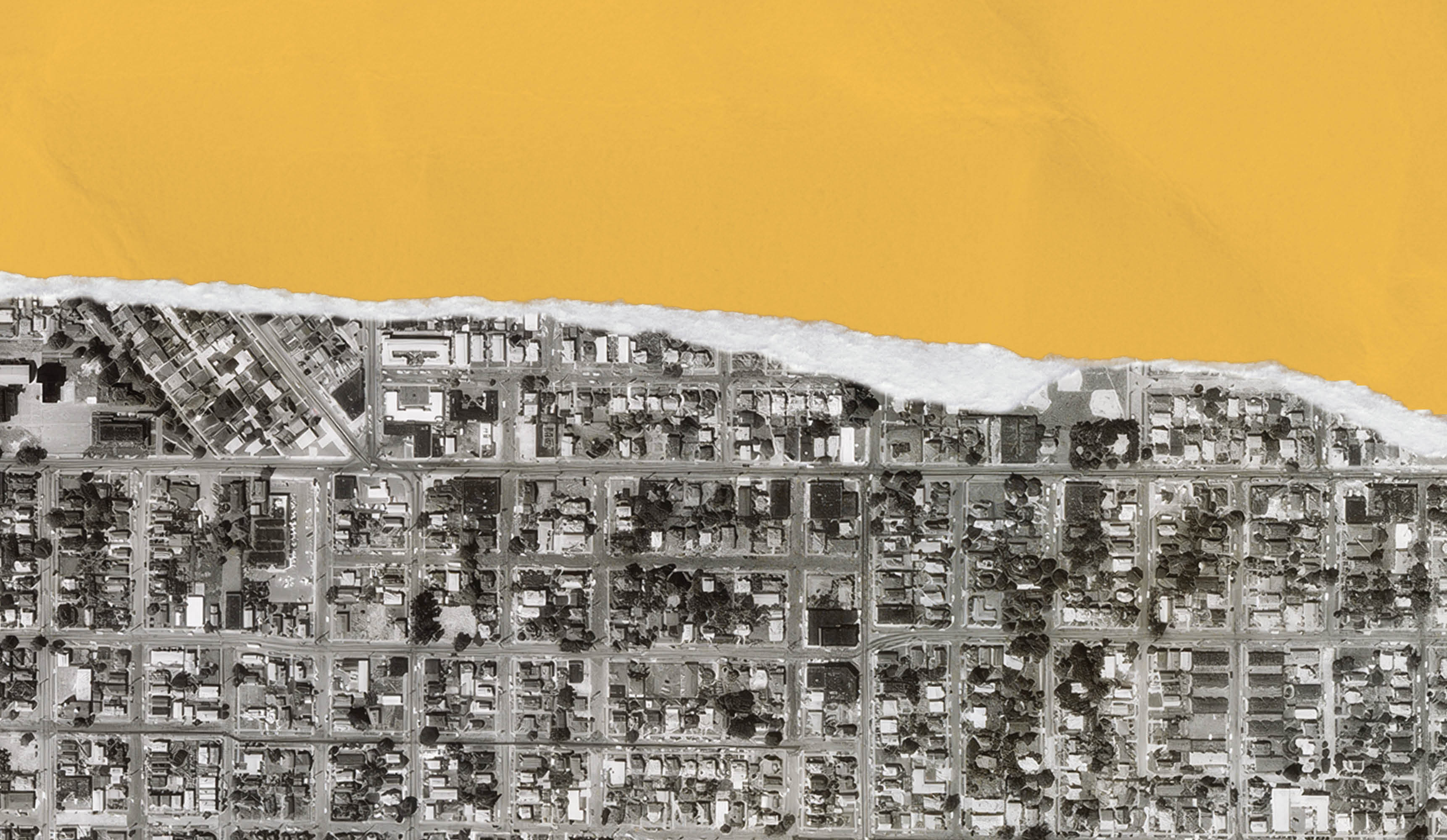
Though the Mount Hood Freeway was never built, its remains hide in plain sight. We can spot the ruins if we look carefully: the ghost ramp coming off the east side of the Marquam Bridge; the stub junction hanging off the elevated interchange above the Oregon Museum of Science and Industry; the sporadic parking lots along Powell Boulevard where homes and businesses once stood.
Today I sit in one such monument, eating an apple under a big old oak: Piccolo Park, nestled between Clinton and Division Streets at 28th Avenue, occupies a space where homes were leveled for the proposed freeway. By 1976, demolitions had destroyed structures on half of the 415 parcels purchased within the path of the freeway. I came to this tiny city park to think about the confluence of human engineering, people, and earth’s systems. I came here to imagine the freeway viaducts and stacked ramps above me with their designers’ carefully calculated angles of concrete and steel, using and improving upon the techniques used by ancient peoples and the hands of humans and the machines their minds and hands created. The ramps bank and curve, lines following lines, finding as safe a passage as possible.
I imagine, too, the hands of Flora Rigotti, whose family immigrated from Italy and who, many years later, found herself living in the proposed freeway’s path. Her hands write a letter to city commissioner and freeway proponent William Bowes, pleading with him to stop the project. Her hands forage wild mushrooms and play the keys of an accordion, just as her 2012 obituary in The Oregonian reports. Her husband washes his hands after a long day of loading and driving the garbage truck he purchased to service the neighborhood. He dries his hands on a towel hanging on the oven door, still warm from the meal’s heat.
As I try to understand the highway system, I tap into others’ stories and ideas: the stories my dad tells me; the work of scholars like Ballestrem, who taught me about roads and said, “This story must be told and retold and retold”; anyone who will talk about highways with me, paving new thoroughfares in my thinking.
When I read about the history of highways, I see creativity everywhere: in human work and thought, in engineers’ drawings, and in political dialogue. I see creativity in Oregon’s adoption of a gasoline tax in 1919—the first state to try out the concept that those who use the highways most should also pay for them. I see it, too, in the state’s mid-century refusal to adopt a white-dotted highway line instead of more visible yellow lines, defying the mandate of federal officials who later reversed themselves to align with Oregon in 1971. And in how Governor Tom McCall, facing the 1973 oil crisis, took advantage of new federal rules put in place by President Nixon to reallocate Interstate Highway Trust Fund dollars from the Mount Hood Freeway into the light rail system we know today as the MAX.
Every large public project gives us a chance to carve out new ways. The I-5 Rose Quarter Improvement Project in Portland, still in its infancy in the typical lifespan of public infrastructure, is one such opportunity. Human creativity has dreamed up a large land bridge, a buildable highway cover that will span the interstate, reconnecting the Albina neighborhood that was once divided by the construction of I-5 and I-84, and adding new auxiliary lanes and wider shoulders along I-5.
ODOT cites safety and traffic reasons for the agency’s wish to expand the freeway. The young activists that make up Sunrise Movement PDX have put up powerful resistance to the plan, asking the state to “fund our futures, not freeways,” and holding strikes against freeway expansion, which they have dubbed Youth vs. ODOT. No More Freeways, another group that opposes ODOT’s expansion plans, points to the well-studied phenomenon of “induced demand,” in which additional lanes or freeways inevitably encourage vehicles to fill them, leading to the same levels of congestion that existed before expansion.
The beautiful promises baked into the plan, however, are both the Reconnecting Albina Planning Project, as the land bridges or “freeway caps” are called, and the extensive community involvement behind it. The architectural drawings of the proposed land bridge are stunning in the way they are supposed to be, filled with ample green spaces, housing, and cultural gathering spaces. Published by the Albina Vision Trust, a nonprofit focused on this restorative redevelopment, the images help Portlanders and others understand the goal of the freeway cap and other city projects: to “[reconnect and reclaim] wrongfully condemned land for the restitution of a thriving, sustainable, resilient community.” Although the Rose Quarter project has been approved by the FWHA, recent cuts to federal road spending mean its funding is now uncertain, as are the priorities and phases of the build. All of those involved, from community to the highway engineers to the politicians, have the chance to listen, to be curious, to take the route of tenderness.
When I’m especially tapped into my commute, as I drive a perfectly banked cloverleaf to join the other cars and trucks on the freeway in a communally orchestrated zipper merge, or ride in a MAX train gliding over the Steel Bridge—the only double-decker bridge in the world with independent lifts, and one of the most multimodal bridges anywhere, carrying pedestrians, bicycles, buses, freight and passenger trains, trucks, and cars in addition to the MAX—I feel something akin to a thrill. In these moments I see the budding collective genius in the engineering of these systems, something we will certainly require as we face the climate crises ahead. But also, I plainly see our interconnectedness. When I see a truck, I also see the driver sitting high up in the rig, carrying freight along our human-made routes. I see all of us—the highway engineers, government officials, travelers, and communities involved in projects like the Rose Quarter redevelopment—working to invent the marvels that will solve problems and to make conscious the impacts of our massive systems, considering what we might lose and what we have to gain.
Comments
1 comments have been posted.
Such an amazing article! So beautifully written and so informative about our highways. Thank you Dawn for writing this. The flashback to Flora rigotti and to her husband drying "his hands on a towel hanging on the oven door, still warm from the meal's heat" was sublime. The images that accompany the article in the magazine version are greatly enhancing to the work, I wish they were included on this web version of the article so people who I send this link would get to see them.
Bernard | December 2025 | NE Portland
Add a Comment